Google Street View
Take a field trip without leaving the classroom!
There are three main ways to take a Google Street View field trip.
Read below to see which way will work best for your students, content, and device availability.
Read below to see which way will work best for your students, content, and device availability.
The Street View app has some amazing collections of images, but navigation is quite different than Google Maps. The street view app was designed to work with a phone and Google Cardboard, but this app can also be used on an iPad.
|
Google Maps is a great option for the iPads. When you swipe up, you can usually access Street View 360' images for popular locations. Turning on the compass tool is also helpful in creating a more immersive experience. Additionally, links can be airdropped or made into QR codes for easier access when working with younger students. Just check to make sure they work first! Some example QR code field trips are posted in the slide show below.
|
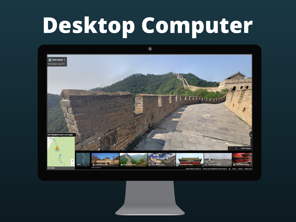
Both the Street View collections and Google Maps locations are accessible on a computer from an internet browser. Students can swipe up, down, left, and right with their curser to view the 360 images. Some places are actually easier to find this way, such as the Great Wall of China.
|
